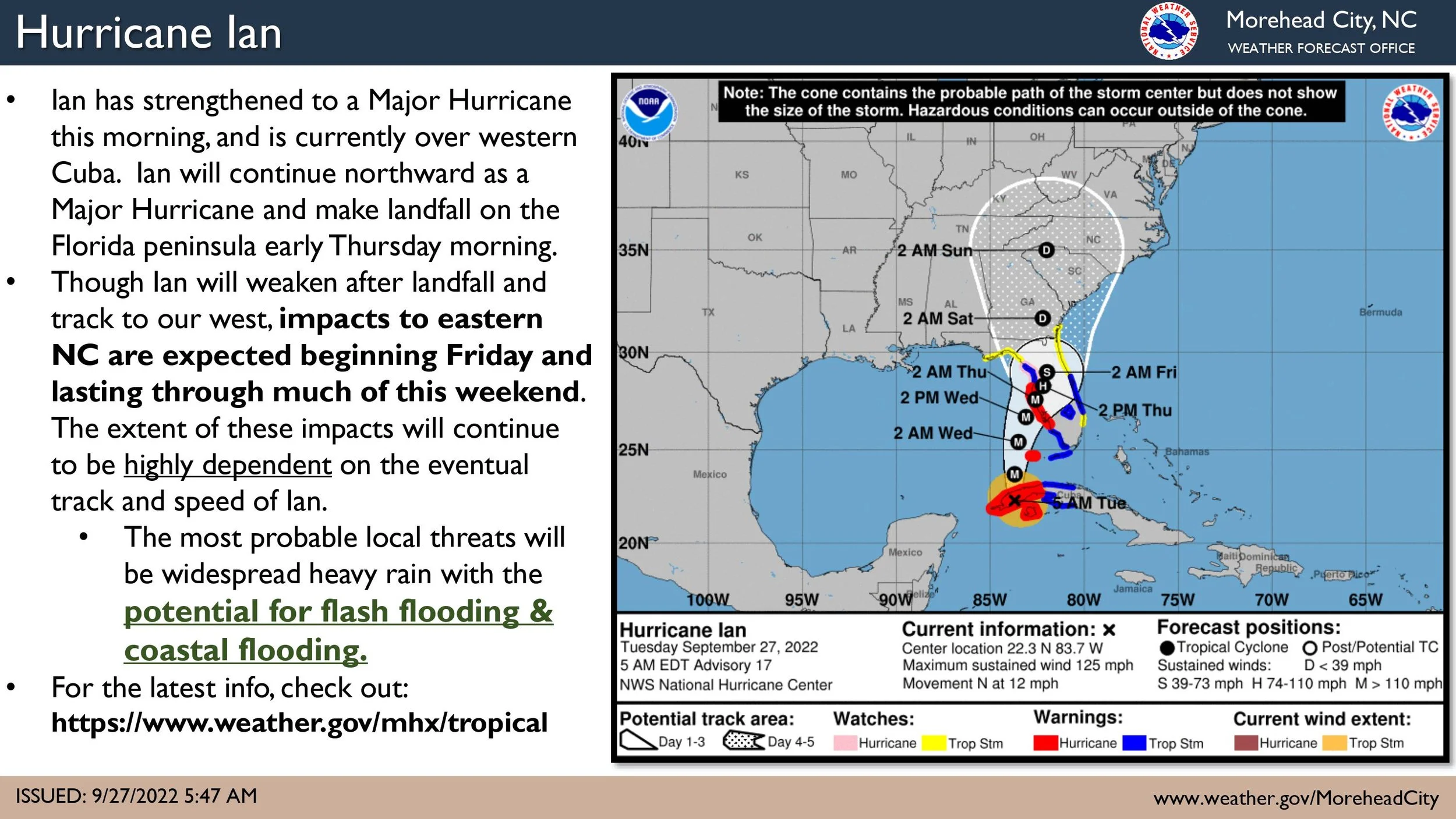
NWS: Ian has strengthened into a Major Hurricane
Ian has strengthened into a Major Hurricane this morning, and has made landfall over western Cuba. Hurricane Ian is expected to continue north into the Gulf of Mexico today, and then make landfall on the Florida peninsula early Thursday morning. There have been some slight changes in the first 48-60 hours of the track forecast, however the expected position of Ian through the rest of the Southeast US remains largely unchanged.
Confidence continues to increase that Eastern NC will feel impacts from this system, with the greatest local threats being heavy rainfall and the potential for flash flooding, as well as coastal flooding.
It remains too early for specific details regarding severity and timing of the coastal flooding impacts, but we will continue to update as forecast confidence and probabilities increase.
Rainfall totals have increased ever so slightly, and we continue to expect the heaviest rainfall along the coast. However, please be aware that the rainfall forecast is highly dependent on the eventual track and speed of Ian through the Southeast US, and the area of maximum rainfall may shift.


